Adding one or more of the following conditions will narrow your search to match all the fields you've given value to.
Belongs to category:
--- All categories ---
Bug Cable / Comm. Control Drainage Electricity Gas, Fuel, Heating Info Lighting Sewage Traffic Unknown Water
Country:
--- All countries ---
Albania Andorra Argentina Aruba Australia Austria Azerbaijan Azores (Portugal) Bangladesh Belarus Belgium Bosnia and Herzegovina Bulgaria Cambodia Canada Canary Islands (Spain) Chile China Colombia Croatia Cuba Cyprus Czech Republic Denmark Ecuador Egypt Estonia Ethiopia Finland France Galápagos (Ecuador) Georgia Germany Greece Hong Kong Hungary Iceland India Indonesia Ireland Israel Italy Japan Jordan Kosovo Luxembourg Maldives Malta Mexico Moldova Montenegro Netherlands Northern Cyprus Norway Palestine Peru Philippines Poland Portugal Romania Russia Saudi Arabia Seychelles Singapore Slovakia Slovenia South Africa South Korea Spain Sweden Switzerland Taiwan Thailand Turkey Ukraine United Arab Emirates United Kingdom USA Vatican City State Vietnam
City:
--- All cities ---
Click for advance search
Cover's manufacturer:
--- All manufacturers ---
Shape:
--- All shapes ---
Circle Elliptical Hexagonal Octagonal Other Rectangle Square Square round corners
Material:
--- All materials ---
Concrete / Stone Concrete and glass Concrete, metal frame Metal Metal and Concrete Metal and glass Plastic Rubber Wood Wood and metal
Consumer:
--- All consumers ---
Taken by:
--- All photographers ---
Have a standard of:
--- All standards ---
Tags:
--- All tags (including no tags) ---
Special type: Note that selecting a value from this field will delete the entry in the first search field (Word or words)
--- Ignore a special type (all covers) ---
Coal holes
Tree grates
Outdoor sculpture
Poetry and literature
Chameleon covers
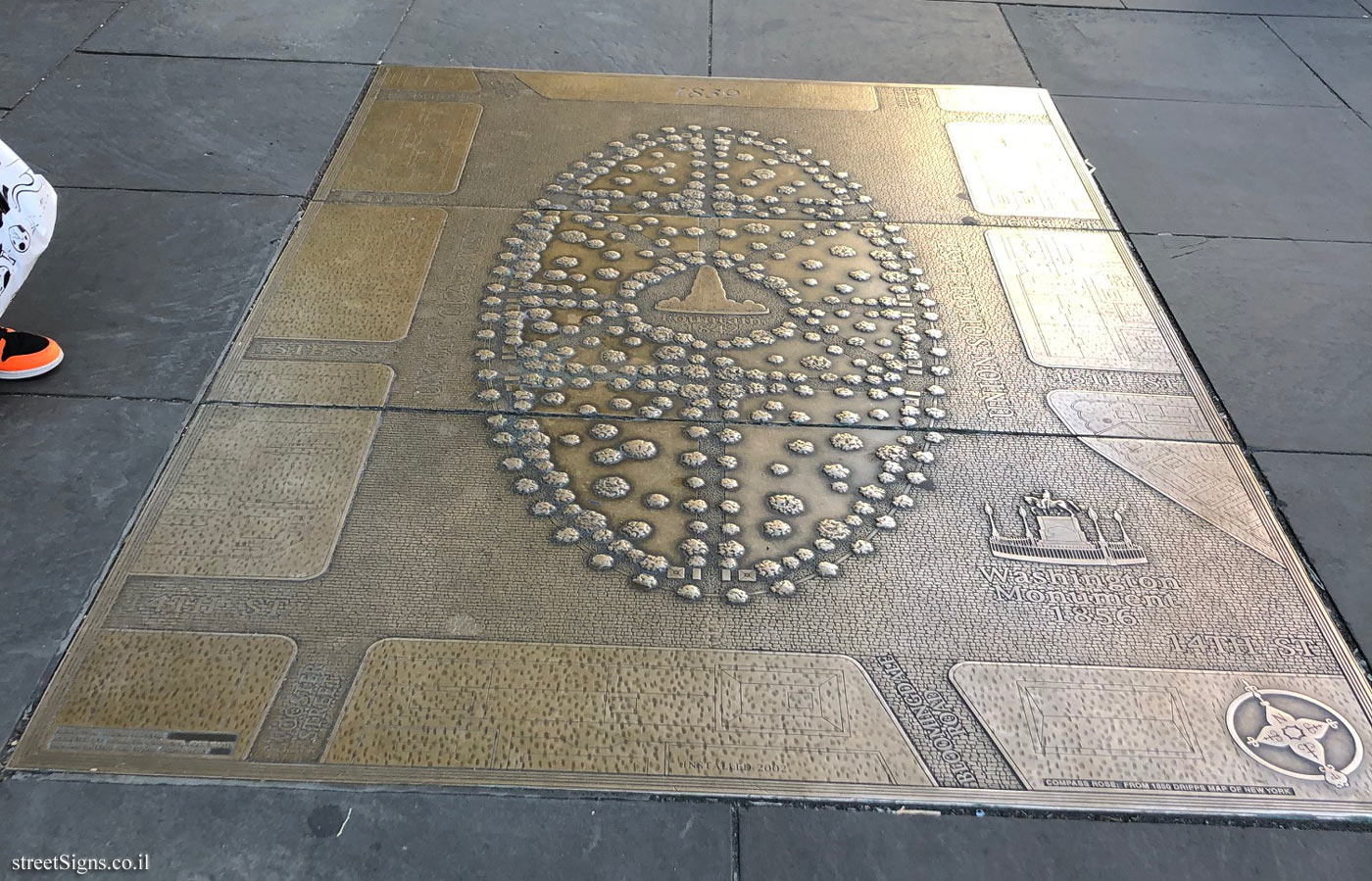
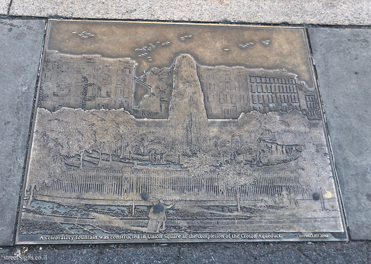
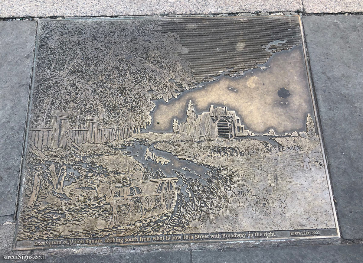
Union Square Route
Independence Trail (TLV)
Entin Square tiles - Tel Aviv University
Stumbling stone (Stolpersteine) - memorial for the victims of the Nazis
Budapest - the Roman frontier - Danubian Limes


 Click for the item in The ultimate street signs site

 Click for all covers belonging to Union Square Route
 Click for the map of all covers belonging to Union Square Route
 Click for all covers of this type