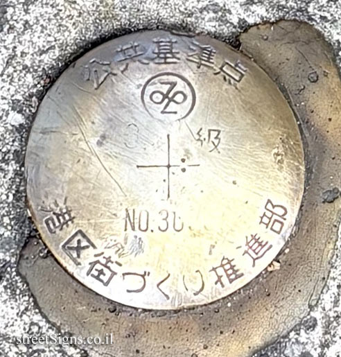
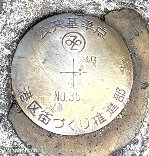
A geodetic survey marker serving as a physical control and reference point, with precisely established horizontal coordinates and elevation. Such points are used in land surveying, mapping, and the planning of infrastructure and urban development projects.
At the centre of the marker, installed by the Minato Ward Urban Development Promotion Department, a cross marks the exact location of the control point, over which surveying equipment is centred.
Translation of the text on the cover: Public Control Point [Minato Ward emblem] Class 3 No. 30 Minato Ward Urban Development Promotion Department



 Possible Worlds Ltd.
 © 2017-2026




 Click for all covers of this type