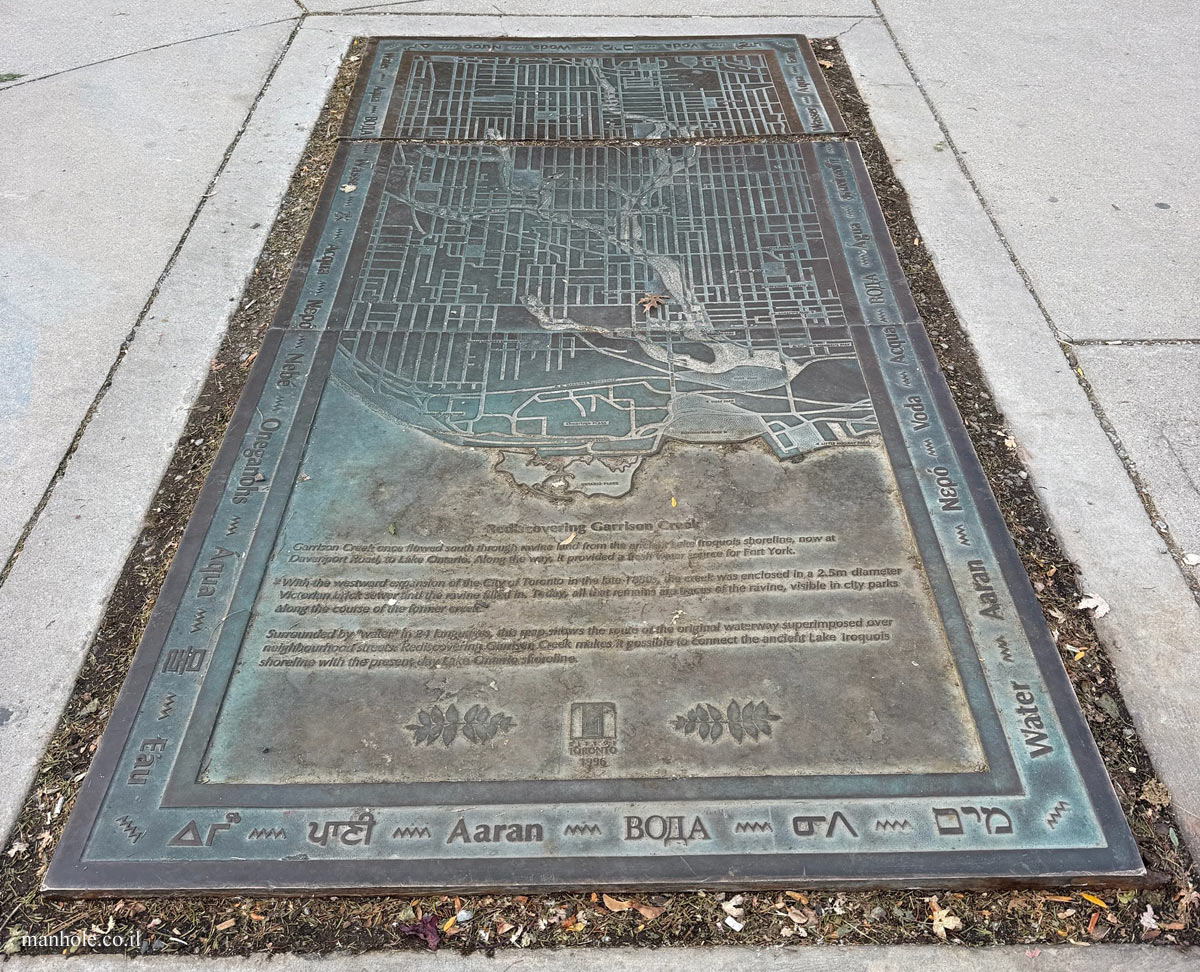
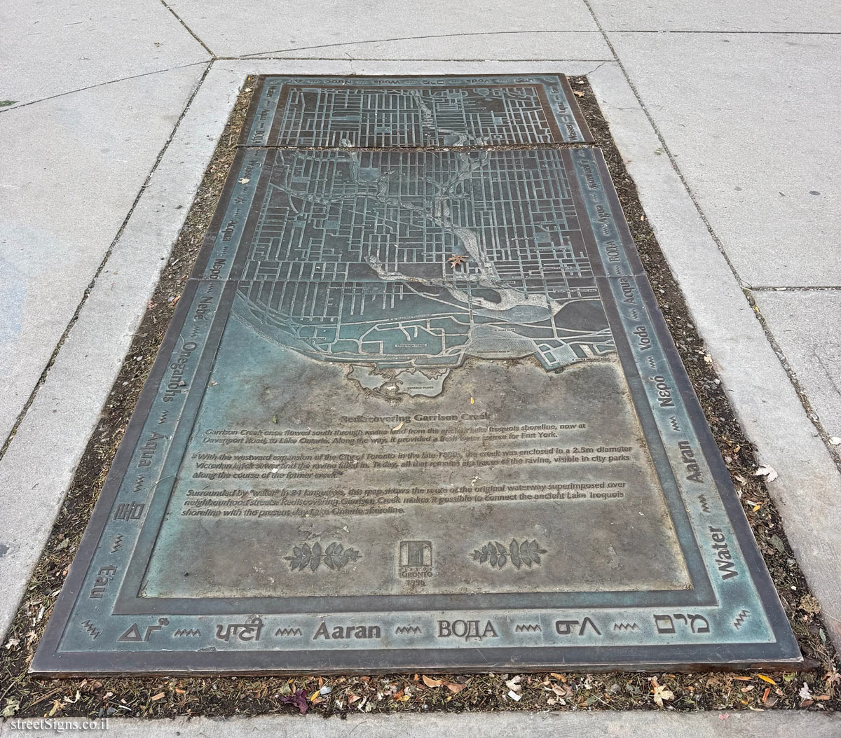
Garrison Creek once flowed south through ravine land from the ancient Lake Iroquois shoreline, now at Davenport Road, to Lake Ontario. Along the way, it provided a fresh water source for Fort York.
With the westwand expansion of the City of Toronto in the late 1880s, the creek was enclosed in a 2.5m diameter Victorian brick sewer and the ravine filled in. Today, all that remains are traces of the ravine, visible in city parks along the course of the former creek.
Surrounded by "water" in 24 languages, this map shows the route of the original waterway superimposed over neighbourhood streets. Rediscovering Garrison Creek makes it possible to connect the ancient Lake Iroquois shoreline with the present day Lake Ontario shoreline.
CITY OF TORONTO 1996
ΔΓω / पानी / Aaran / ᓂᐱ / מים / Water / Aaran / Νερό / Voda / Acqua / ВОДА / Agua / தண்ணீர் / Wasser / Agua / Eau / पानी / Voda / מים / Woda / Nước / ΔΓω / Water / Aqua / ВОДА / Wasser / 水 / Acqua / Νερό / Nebé / Oneganohs / Áqua / 물 / Eau
תרגום הכתוב על המכסה: נחל גאריסון זרם בעבר דרומה לאורך ערוץ עמוק, מקו החוף של אגם אירוקווי הקדום, שנמצא כיום באזור רחוב דבנפורט, ועד לאגם אונטריו. בדרכו סיפק מקור מים מתוקים למבצר יורק.
עם התרחבותה של העיר טורונטו מערבה בסוף שנות ה-80 של המאה ה-19, הוכנס הנחל לתוך צינור ביוב ויקטוריאני מלבנים, בקוטר 2.5 מטרים, והערוץ מולא. כיום נותרו רק שרידים של הערוץ, הנראים בפארקים עירוניים לאורך תוואי הנחל לשעבר.
המפה, המוקפת במילה „מים” ב-24 שפות, מציגה את תוואי נתיב המים המקורי כשהוא משורטט על גבי רחובות השכונות. גילויו מחדש של נחל גאריסון מאפשר לחבר בין קו החוף הקדום של אגם אירוקווי לבין אגם אונטריו של ימינו.



 לחצו לערך באתר שלטי הרחוב האולטימטיבי
  עולמות אפשריים בע"מ
  © 2017-2026


 לחצו לכל המכסים מאותו סוג